Maps
Maps are an important feature, especially for events that are held in physical locations. It can enhance the attendee experience by providing valuable information and making it easier to navigate the event. There are two types of Maps in Eventify, Interactive Map and Location Map.
You can rename Maps feature to any name of your choice and it will display the given name in the app and web for the event.
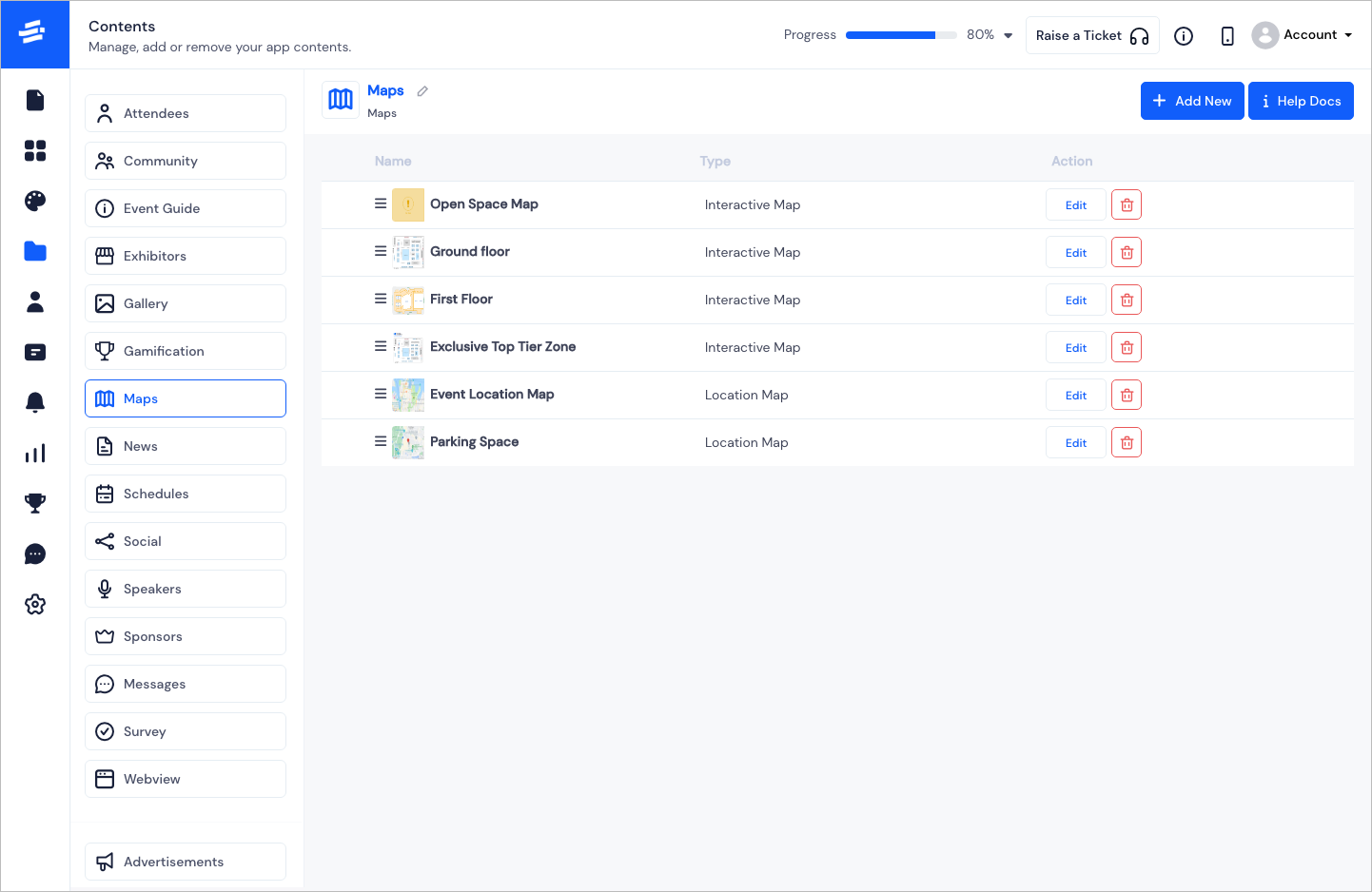
To Add a new Map, click on the Add New button. You will get options to select either the Interactive Map or the Location Map. On selecting one, the respective Add Map pop-up window will appear.
Interactive Map#
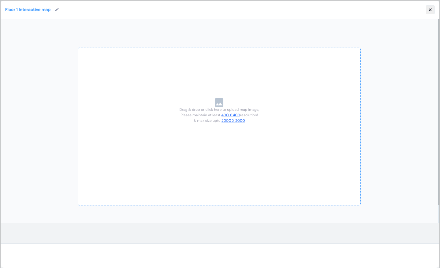
- Start with the Map name and Save it. This will create the canvas for your Interactive Map

- Upload the floor plan on the canvas. The can should be of minimum 400 X 400 and maximum 2000 X 2000
Note: In case you have a large map, you can zoom in and out on the map to get better views of the area.
- Click on Add Booth to add a booth area on you map. The area marker will appear on the canvas.
Note: You can resize the area as per your requirement.
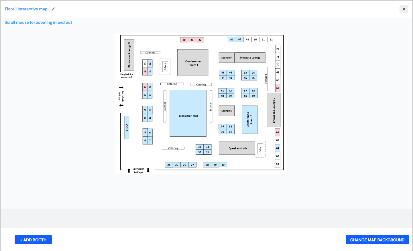
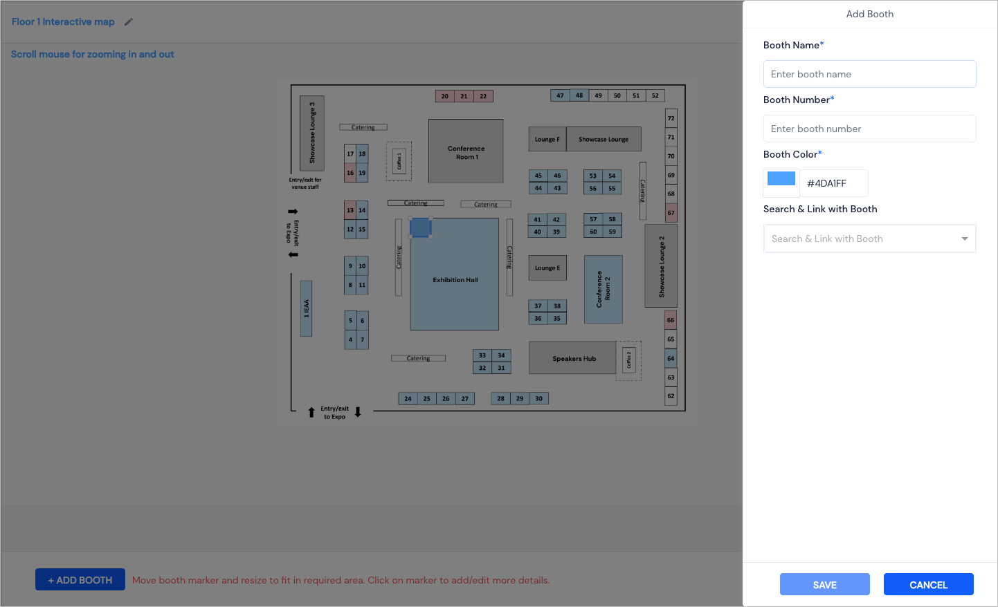
- Click on the area box to add booth details.
- Enter the Booth Name and Booth Number to identify the booth on the map
- Choose a Booth Colour that will identify the booth.
- Associate the booth with multiple exhibitors, sponsors, seakers and sessions or you can also leave it blank to associate later from Search & Link with Booth.
- Click on Save to add the booth.
You can also edit or delete a booth.
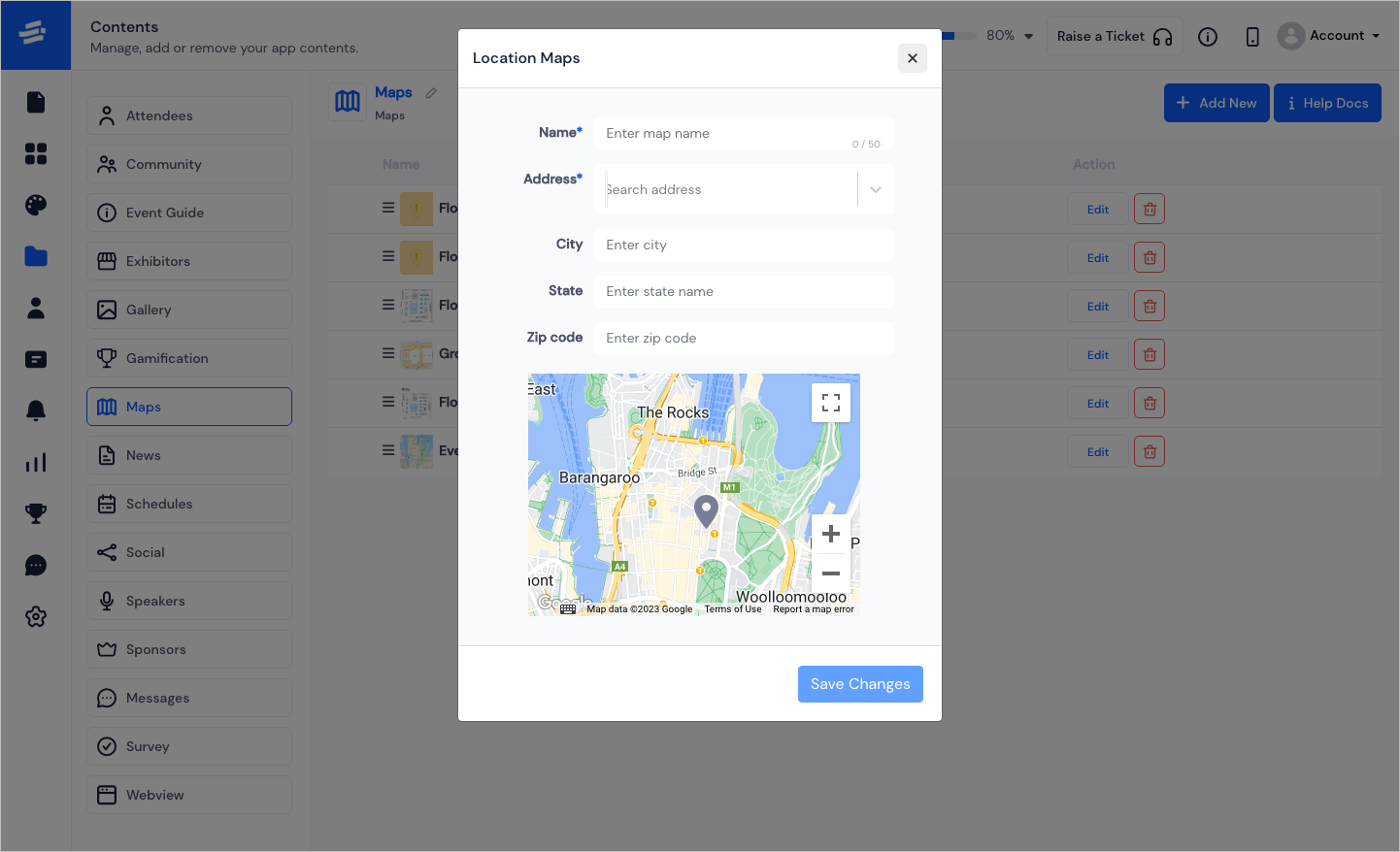
Location Map#
Location Map is for adding a more generic location of the venue so that it is searchable. With few simple steps, you can add the Location Map
️Here are the steps to add a Location Map.
Enter the Map Name
Search and select the Address
The City and State will be autofilled or you can also add them yourself.
Enter the Zipcode
Click on Save to add the booth
You can also edit, delete or drag to rearrange the maps.
FAQs#
Q: What is the functionality of the Maps feature?
The Maps feature helps an attendee to locate the positions from their app. There are two types of maps:
Location Map: Organizers can point the address of the event venue on the Google Map for attendees to locate them through GPS.
Interactive Map: It provides the floor plan to attendees to spot the exhibitor booth position on the venue.
Q: How many Maps can be added for a single event?
There is no limitation for setting up locations or floor plans.
Q: Can we change the name Maps?
Yes, organizers from the admin panel can change the name of all the features that appear on the menu screen including Maps.
Q: Who can add the booth name and number on the floor plan?
Organizers from the admin panel can upload floor maps as an interactive map from the Admin Panel's Maps page. And organizers can also set positions on the map to add exhibitors' details such as their name, booth number, and contact information etc.
Q: Can we remove the Maps feature for virtual events?
Yes, there is an option in the admin panel to add or remove features based on the requirements.